
The weather along your route, for the hour you'll be there
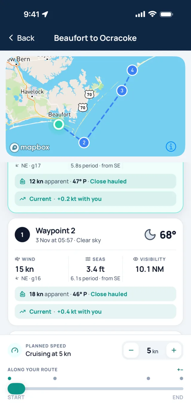
Draw a route, set your cruising speed, and Sea Window times the forecast to your arrival at every waypoint. Wind, seas, visibility and current for each leg, read as one passage instead of one forecast for the harbour you leave from.

How route weather works
A forecast for the marina tells you about the first hour. A coastal trip lasts four hours or two days, and the weather moves while you do. Route weather follows you down the coast.
Draw the route
Tap waypoints on the map, or open a saved plan. Put one at each headland, inlet and change of course.
Set your speed
Your cruising speed over the ground turns distance into an arrival time at every waypoint.
Pick a departure
Leave now, choose a time, or take the best window from the Departure Advisor.
Read the passage
Each waypoint shows the forecast for that place at that hour, from the start to your arrival.
Newport to Edgartown at 6 knots
A 43 nautical mile hop with a morning start. The harbour forecast says light and easy. Route weather shows the southwest sea breeze filling in across Buzzards Bay and meeting you at Woods Hole, right as the current turns foul.
- 1
Leave 07:30
Newport Harbor
- Wind
- 6 kn W
- Seas
- 1.6 ft at 7 s
- Visibility
- 6 NM
- 2
09:15
Off Sakonnet Point
- Wind
- 9 kn SW
- Seas
- 2.3 ft at 6 s
- Current
- 0.5 kn with you
- 3
11:20
Buzzards Bay entrance
- Wind
- 14 kn SW, gusts 19
- Seas
- 2.8 ft at 5 s
- Current
- 0.9 kn across
- 4
Arrive 14:40
Edgartown, via Woods Hole
- Wind
- 18 kn SW, gusts 24
- Seas
- 2.0 ft at 4 s
- Current
- 2.1 kn against you
Leave an hour earlier and you carry the last of the fair stream through Woods Hole, ahead of the strongest breeze.
What each waypoint tells you
Every card is the forecast for one spot at one time: the hour you'll be there at your speed. Change the speed and every arrival time and every forecast moves with it.
- ArrivalDate and time you reach the waypoint, with the sky at that hour.
- WindSpeed, gusts and direction in knots.
- Apparent windThe wind you'll feel on deck at your speed and heading, and your point of sail: close hauled, reaching or running.
- SeasWave height, period and direction, so a long swell and a short chop look different.
- VisibilityIn nautical miles, so fog on a later leg shows up before you leave the dock.
- CurrentWith you, against you or setting you across, with its speed.
Built for the days before and the morning of
Coastal plans change with every forecast run. Route weather keeps up, and it is still there when the signal drops.
Find the best time to leave- Model agreementA badge for each day says whether GFS, ICON and ECMWF agree, mostly agree or disagree, so you know how far to trust a forecast three days out.
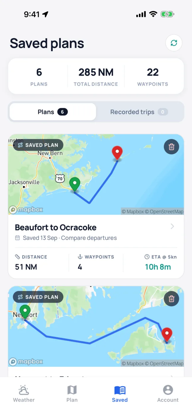
- Saved plansKeep every route with its distance, waypoints and passage time. Open it again whenever a new forecast lands.
- No signalYour latest route weather, forecasts and tides stay on the phone for 24 hours, and downloaded map regions keep the map on screen.
- Any speedSail or power, set the speed you actually make good. Trawlers that hold a steady speed get especially tight arrival times.
- Your accountRoutes sync to your iPhone and iPad through your account.
Route weather questions
What is route weather?
Route weather is the forecast along a planned passage, timed to when you reach each point. Sea Window works out your arrival time at every waypoint from your cruising speed, then shows the wind, seas, visibility and current forecast for that place at that hour.
How many waypoints can a route have?
Enough for any coastal hop. Put a waypoint at each headland, inlet and change of course. Long passages read best split into legs, each with its own plan.
What speed should I enter?
The average speed you make good over the ground on a passage like this one. Change it at any time and every arrival time and forecast updates with it.
Does route weather include tidal currents?
Yes. Each waypoint shows the current you'll meet there and whether it runs with you, against you or across your course.
Where does the forecast come from?
The ECMWF, ICON and GFS global models, with a daily badge that shows whether they agree. Tides and currents come from NOAA stations in US waters and models elsewhere.
Can I see route weather offline?
Yes. The latest route weather for your plans stays on your phone for 24 hours, and it refreshes on its own when you're back in range.
Guides on passage weather
How to plan a coastal passage
From route and timing to tidal gates, bolt holes and the final check before you leave.
Passage planningHow to find a weather window for a coastal passage
Turn a forecast into a window that covers the whole trip, including a slow arrival.
Reading forecastsHow to read a marine forecast
Wind, gusts, seas, period, visibility and pressure trend, and what each one means on the water.
Tides and currentsWind against tide: why the sea stands up
What an opposing current does to waves, and how to time an inlet or a headland around it.

See the whole passage before you leave
Every waypoint, at the hour you'll be there.