
The marine forecast, all on one screen
Wind and gusts, the barometer and where it's heading, fog, squalls, waves, tides, official warnings and seven days ahead. Everything a skipper checks before a trip, in one scroll on your iPhone.

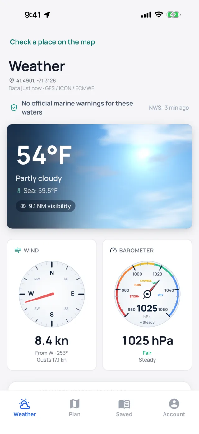
Wind, pressure and the sky, read in seconds
The top of the Weather tab answers the first questions on the dock: how hard is it blowing, which way is the pressure going, and how far can I see.
- WindSpeed, direction and gusts on a compass, in knots or your own unit.
- BarometerPressure in hPa on a storm to dry dial, and how far it has moved in the last three hours.
- Pressure trendA plain-language outlook for the next few hours, including wind shifts and when they arrive.
- Sky and visibilityAir temperature, cloud and visibility in nautical miles.
- Sea temperatureThe water temperature where you are, next to the air.
Waves split into their parts, squalls called by the hour
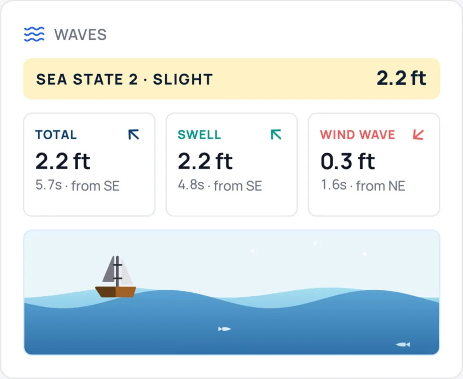
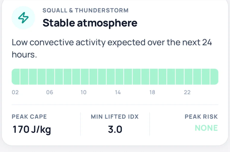
A wave height means little without its period. Sea Window shows the total sea, the swell and the wind wave separately, each with its period and direction. The squall card reads the convection signals in the forecast and tells you when they peak.
- Fog outlookWhen visibility drops, how far, and the lowest it gets in the next 24 hours.
- TidesThe nearest tide station or the global tide model, with the curve and the next four highs and lows.
- Tidal currentsThe nearest NOAA current station with flood, ebb and the next slack.
Seven days ahead, and how far to trust them
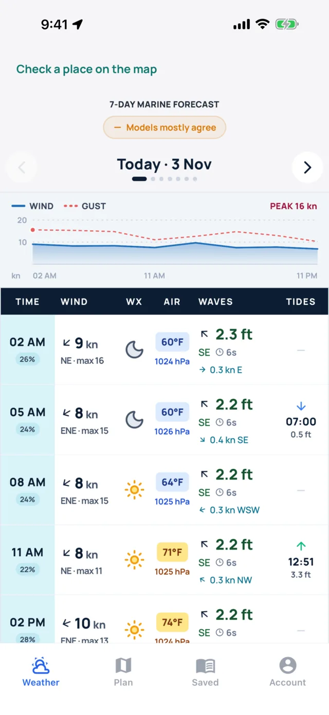
The 7-day marine forecast lines up wind, weather, air temperature, pressure, waves, current and tides in one table, with the wind and gusts charted hour by hour above it. A badge on every day says whether GFS, ICON and ECMWF agree, mostly agree or disagree.
- WindSpeed, direction and the day's peak gust.
- WavesHeight, direction and period, with the current's speed and set.
- TidesHigh and low times in the same row as the weather.
- ConfidenceWhen three models tell the same story, plan on it. When they split, look again tomorrow.
Warnings from the forecaster, readings from the buoy
Models give you the shape of the days ahead. Official warnings and live buoys tell you what the forecaster and the sea are saying right now.
- Marine warningsSmall craft advisories, gale warnings and special marine warnings from the National Weather Service, on the Weather tab and as areas on the map. Checked every 3 minutes.
- Push alertsTurn them on and Sea Window tells you when a new warning covers your home waters.
- Zone forecastsThe forecaster's own text for the NWS marine zone you're in.
- BuoysMeasured wind, waves, pressure and water temperature from NDBC in the US every 15 minutes and Australian buoys every 30 minutes, with 24 hours of history.
- Sun and moonSunrise, sunset, daylight, moon phase and solunar periods, worked out on your phone.
Marine forecast questions
Which forecast models does Sea Window use?
The ECMWF, ICON and GFS global models. The 7-day forecast shows a badge on each day that says whether they agree, mostly agree or disagree.
How far ahead does the marine forecast go?
Seven days, with the wind and gusts charted hour by hour and a table of wind, weather, waves, current and tides for each day.
Does Sea Window show NWS marine warnings?
Yes. Small craft advisories, gale warnings, special marine warnings and other NWS marine alerts appear on the Weather tab and as areas on the map, checked every 3 minutes. You can turn on push alerts for your home waters.
Can I see live buoy readings?
Yes. NDBC buoys and stations in the US update every 15 minutes, Australian buoys every 30 minutes, and each one keeps 24 hours of history for wind, waves, pressure and water temperature.
What does the pressure trend tell me?
How far the barometer has moved in the last three hours, and what that means for the next few: steady weather, a building breeze, or a wind shift and roughly when it arrives.
Does the forecast work outside the US?
Yes. Wind, waves, fog, squall risk, tides and the 7-day forecast cover the world's coasts. NWS warnings and zone forecasts are for US waters, and buoys cover the US and Australia.
Guides on reading the forecast
How to read a marine forecast
Wind, gusts, seas, period, visibility and pressure trend, and what each one means on the water.
Reading forecastsMarine warnings explained
Small craft advisories, gale warnings and special marine warnings, and what each one tells you.
WavesWave height vs wave period
Why period matters as much as height, and how to tell an easy swell from a steep chop.
WavesSwell vs wind waves
Two kinds of sea, how they add up, and why the same height can feel completely different.

The whole marine picture, before you cast off
Wind, sea, sky, tides and warnings, in one place.